Kongshaugen (King’s Hill)
Text Marit Synnøve Vea
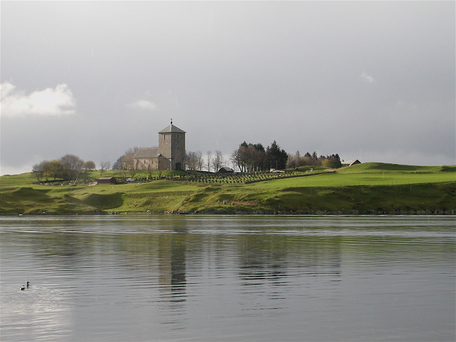
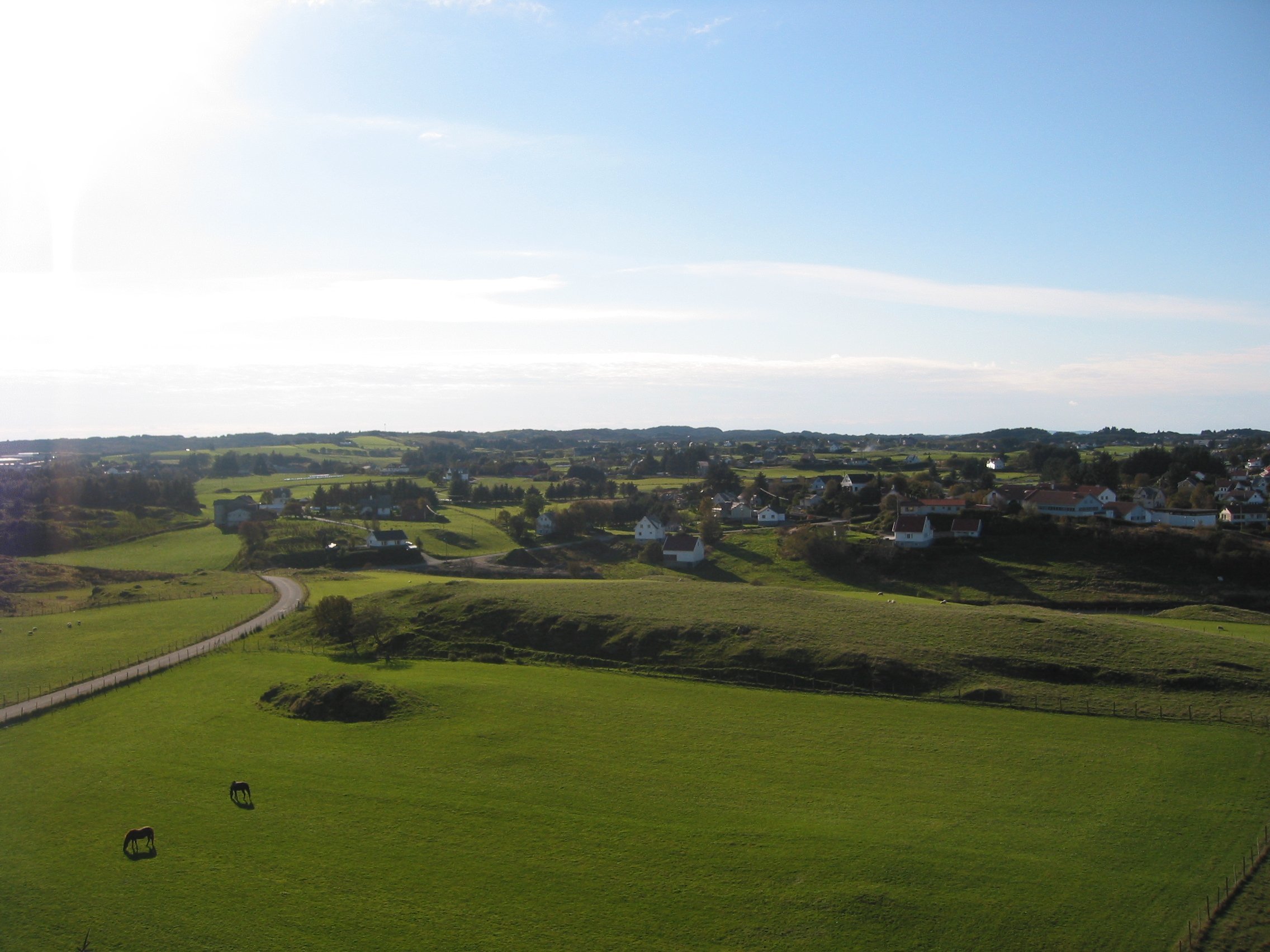
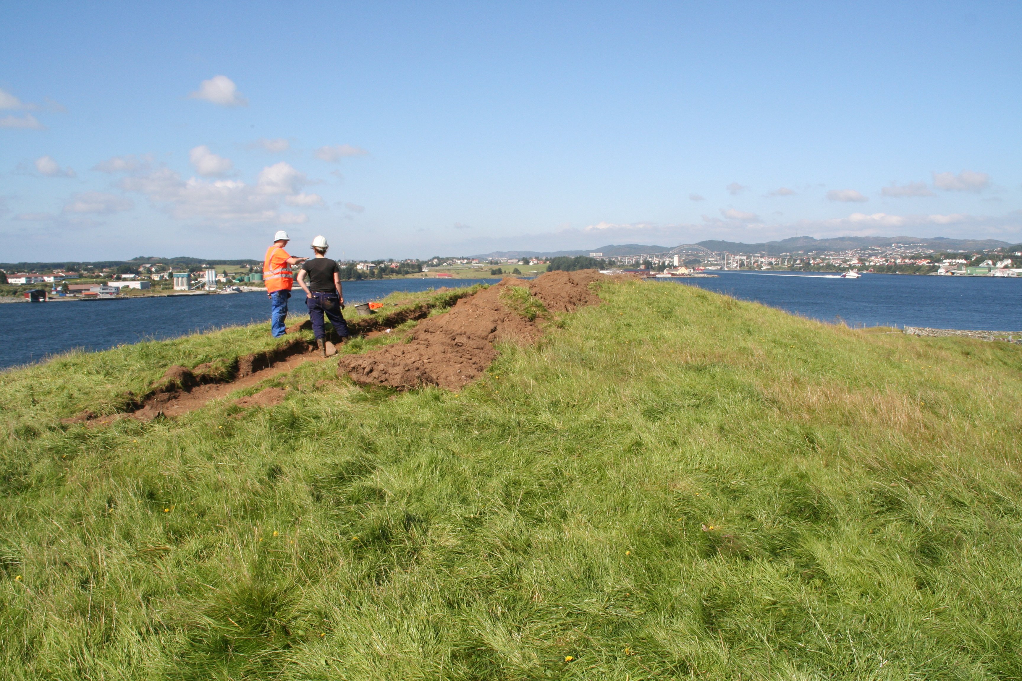
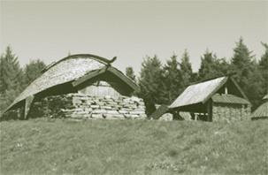
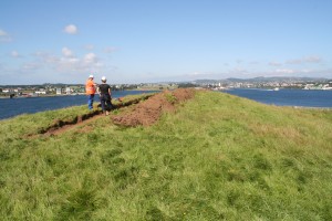
Kongshaugen (King’s Hill) is a height just soutwest of St Olaf’s Church. (Photo Gunnar Strøm)
KONGSHAUGEN (KING’S HILL) – DÅPSHAUGEN (BAPTISM HILL)
Kongshaugen (King’s Hill/Hight) is situated southwest of St Olaf’s church. Some believe that this outstretched height got the name Kongshaugen because Augvald, the kings who gave his name to Avaldsnes, was buried here. Others assume that one of the buildings of the royal manor was located at the height, and that this is the cause of the name.
Kongshaugen has an alternate name; Dåpshaugen (Baptism Hill). According to local traditions, Kongshaugen was the site of the royal court’s assembly (Thing), where Olav Tryggvason baptised the first people of Rogaland in 997.
Through the ages there have been varying theories suggesting that Kongshaugen may have been a place for a burial mound, a building or an assembly site. People knew that there was once a bauta in the middle of the height. Some casual finds have also appeared at Kongshaugen. Among these are “a Simple sword of iron” from the Viking Age and a beautiful gold pendant from the late Roman period.
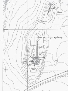
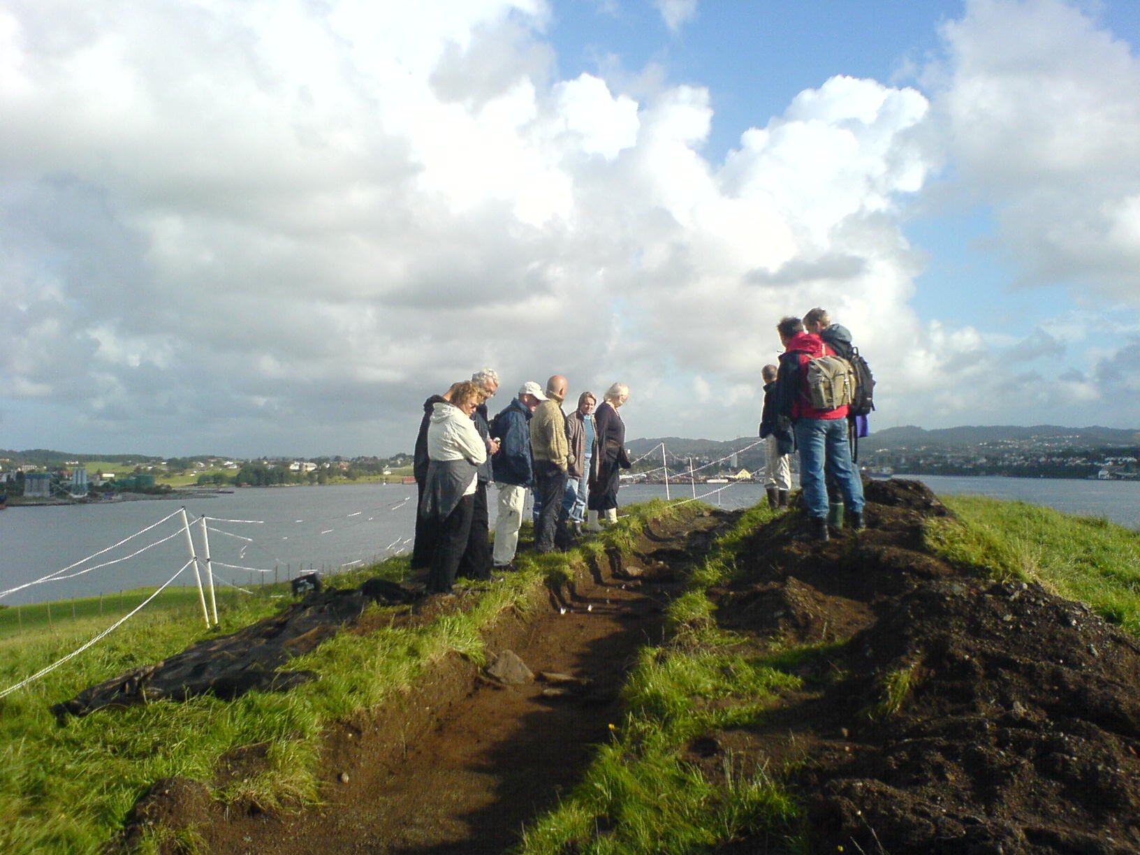
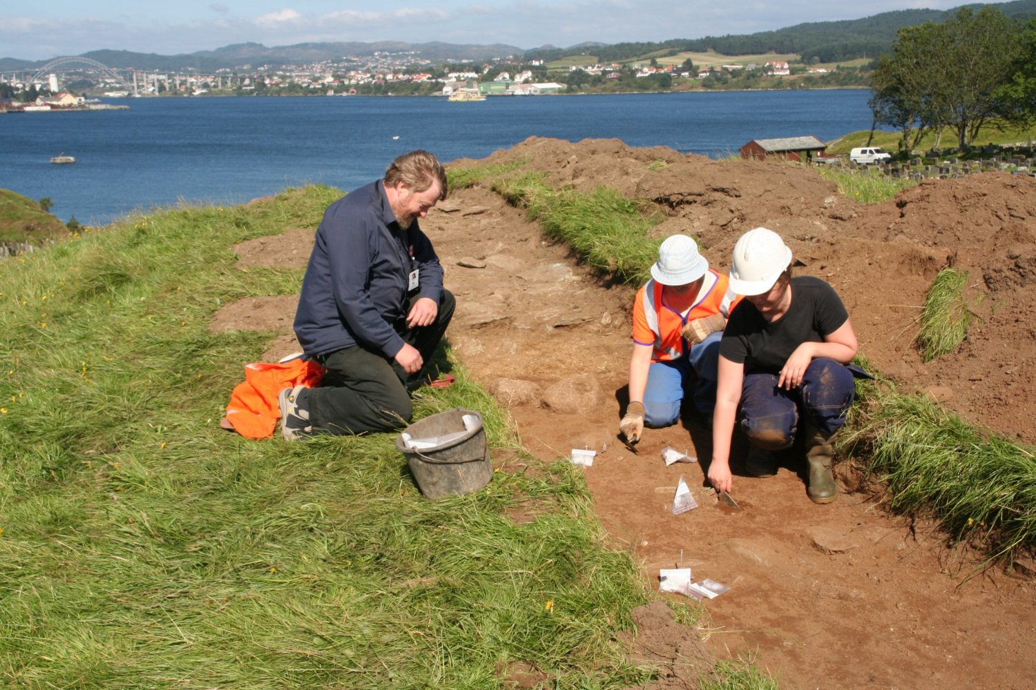
Test trenches at Kongshaugen. (Sketch by Henriette Hafsaas og Olle Hemdorff)
During the spring ploughing at Kongshaugen in 1934, the farm workers found stones, which the vicar Skadberg thought might be traces after an old house. In the same autumn, Jan Petersen, director of the Archaeological Museum in Stavanger, carried out a short survey on the spot. Petersen’s conclusion was that the stone paving he found was not from a building but from a burial site of large dimensions.
Geo-radar survey in 2002
A geo-radar survey of Kongshaugen was carried out in the autumn of 2004. This revealed a rectangular area, which appeared to be a flattened man-made plateau of stones, presumably the foundations of a building. The geo-radar survey also implied that there was a collection of stones at the midst of the height.
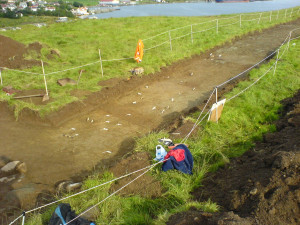
Archaeological test- excavations in 2005/2006
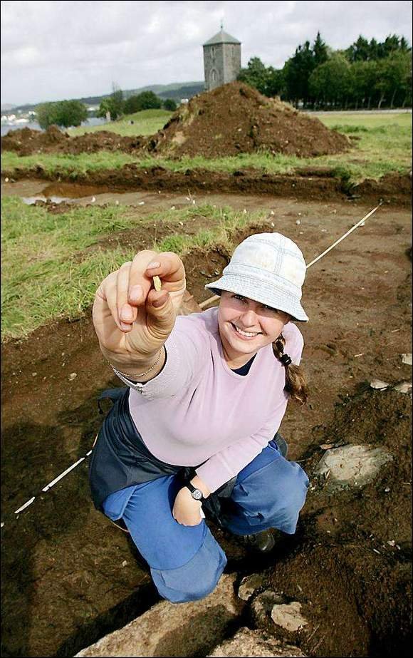
In 2005/2006 Archaeological Museum in Stavanger conducted test excavations at Kongshaugen.
Metal detectors were used prior to the test-excavations but was unable to find any objects from prehistoric or medieval times. When this was done, we made some test trenches by using an excavator to take away the upper layer of the turf.
The investigations revealed several burials on Kongshaugen. Among these were an unopened burial cairn from the Iron Age, a boat grave from the Viking Age and a large circular burial site from the Roman Period, in which a woman from the Viking Age later had been buried. None of the graves, except the last one, was opened.
The three burials on the northern part is located on a peak, with good visability towards the Karmsund strait and other famous monuments in the area. (Photo Ørjan Iversen)
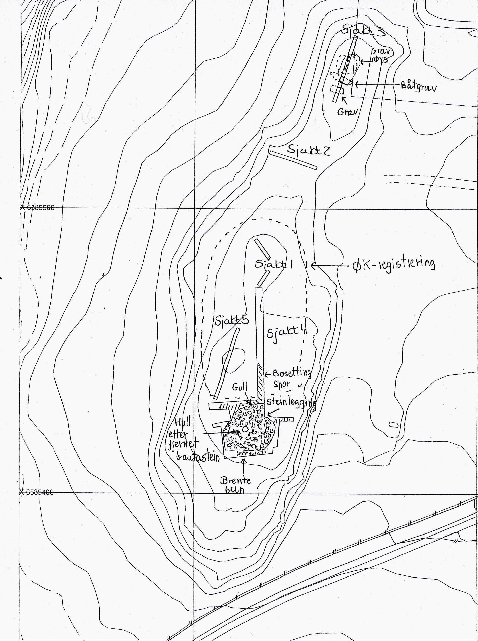
THE NORTHERN PART OF KONGSHAUGEN. TRENCH 3
Three burials were found on the northern part of Kongshaugen. They all appeared to be intact. None of the burials were opened. The burials had not been registered before, but Thomas Kvalevaag (born 1919) seemed to remember that there was a burial mound no longer visible, in the northern part of Kongshaugen. (Topographic Archive)
The three burials are located on a peak, with good visibility towards the Karmsund strait. There is also a good view towards other famous monuments in the area: Flagghaugen, Kjellarhaugen, Rehaugane, Grønhaug, Storhaug, Salhushaugen and De Fem Dårlige Jomfruer.
Burial cairn, Iron Age
A circular burial cairn was located at the highest point of Kongshaugen. The burial cairn had a diameter of 10 m. Approximately 20 cm of turf and cultivated soil was removed. The cairn, built mostly from local slate, seemed to be intact and dates back to the Iron Age.

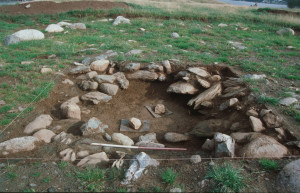
Archaeologists are examinating the boat burial (Photo Ørjan Iversen)
Boat burial
A boat burial was found adjacent to the burial cairn. The boat burial must be younger than the burial cairn, presumably from the Viking Age. Some of the nails were found lying in a line, as if they were lying along the ribbing of the boat.
Only a few of the nails gave a signal when we used the metal detectors, suggesting that the magnetic iron had fallen victim of corrosion. The boat grave showed no signs of having been tampered with and appeared to be intact. It is believed to have been constructed between 600 and 900 AD.
Flat grave
A flat grave was found close to the boat burial. No nails were found in this grave, suggesting another form of unburned burial. The flat grave is believed to be from the period 600-900 AD.
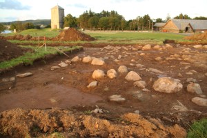
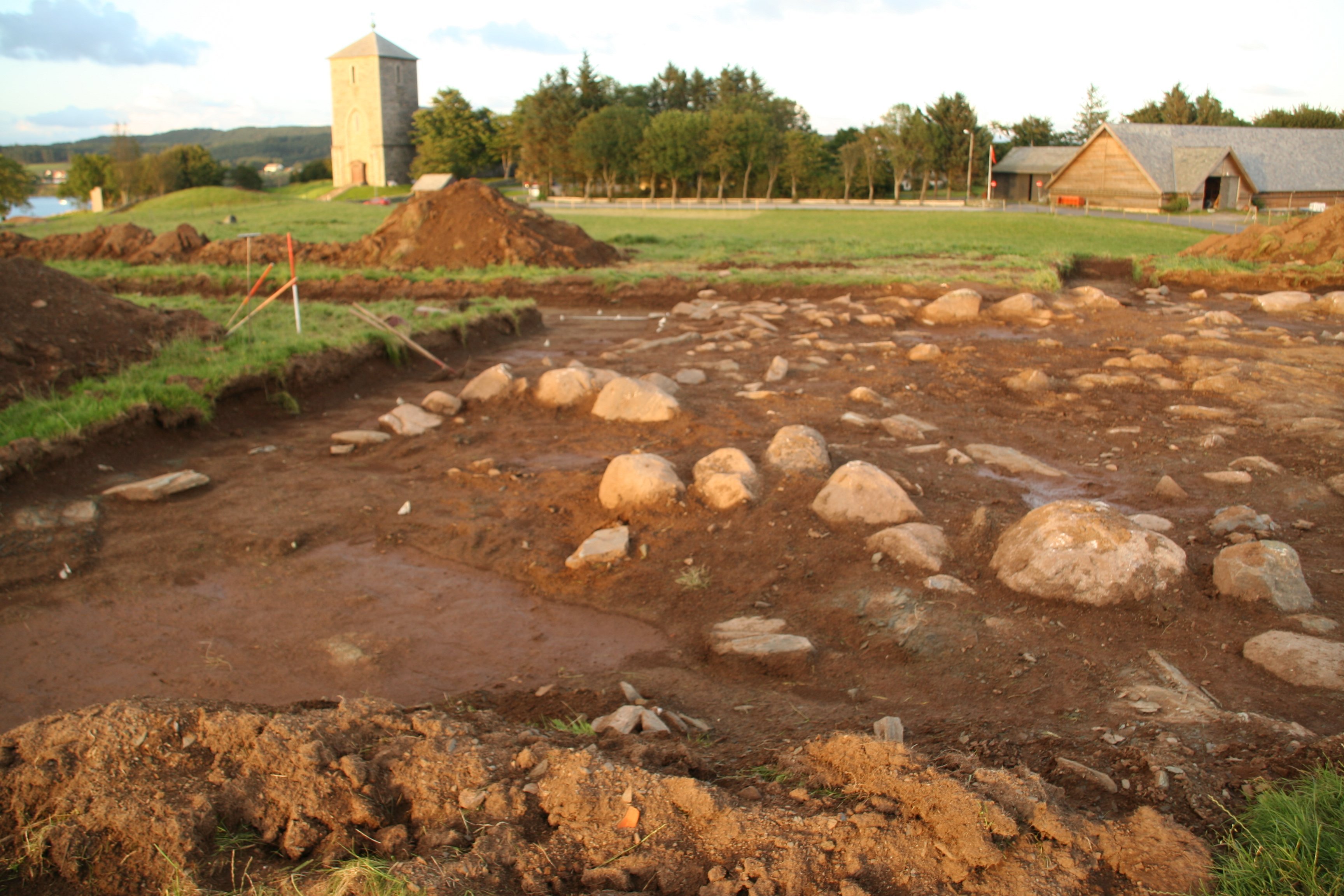
Circular burial site with several secondary cremation burials and a Viking grave. (Photo Marit S. Vea)
THE SOUTHERN PART OF KONGSHAUGEN. TRENCH 4
At the southern part of Kongshaugen there was a circular burial site of stones. The circular stone setting also contained cremated bones from secondary graves and a female Viking Age burial. Written sources tell us that stones were removed from this burial site in the 1800s. It was then found “a simple iron sword”. Jan Petersen also conducted a short survey at this site in 1934.
Circular stone setting – with a primary burial from the Roman Age
The circular burial site had a diameter of between 17 – 20 m. It was not excavated, so we assume that the central burial chamber is still underneath the stones. The main grave is probably from the late Roman period.
It was hoped that the entire paved area would be uncovered in 2005, but unfortunately time ran out. The northeast corner was not uncovered, neither the boundary of the burial to the west of the site.
The ” Viking woman with the thunderstone” was burried in a cairn placed in an old burial site from the Roman Age. (Photo: Am, UiS)
Secondary cremation burials
On the circular pavement’s outer edge to the south, we found charred human remains, believed to be the result of secondary burials. Both cremated and unburned graves were laid under stone cairns in the Roman period. Cremated graves on the edge of a burial site indicate that people were in awe of the person who was buried in the central grave, i.e. the person for whom the grave was originally made.
Secondary burial from the Viking Age
Just to the west of the stone paving, a secondary burial measuring 1,8 m x 0,8 m was discovered. This is believed to be the grave that was robbed during the 19th century, where “a simple iron sword” was found. For this reason, people believed that the person buried here was a man.
Three glass pearls were found in the grave during the surveys in 2005. The subsequent excavations in 2006 revealed a further seven glass pearls, suggesting that the secondary grave had been occupied by a woman who lived in the Viking Age. When she died, she was buried in a cairn placed inside an old burial site stemming from the Roman Age.
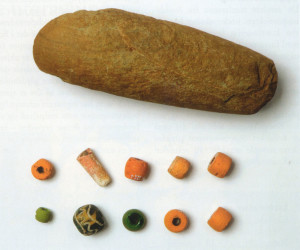
In the female Viking burial there were a greenstone axe from the Stone Age and 10 glass pearls. (Photo Terje Tveit, AmS)
The iron sword that was found in the 19th century might have been a weaving sword for a woman. A weaving sword made of iron indicates that the person buried was of high social status.
A thunderstone with magical powers
A greenstone axe from the Stone Age (9000 – 4000 BC) was also found in the grave. This axe seemed to be part of the burial treasure and was presumably placed in the grave along with the woman because of the magical powers such axes were believed to hold. The Vikings were particularly superstitious and often placed Stone Age axes, known as “thunderstones” (tordenkiler) in the graves. They believed that these thunderstones came from the lightening created by the god Thor as he hurled his hammer Mjölnir around in the sky during thunderstorms.
Why was the woman equipped with a “magical” stone axe? Was there a belief that the axe would protect her on her journey to the next world? Or was the axe meant to protect those still living and ensure that the women did not return to haunt them as a ghost?
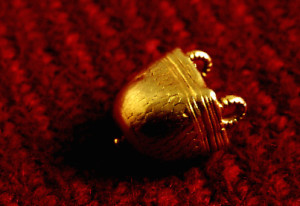
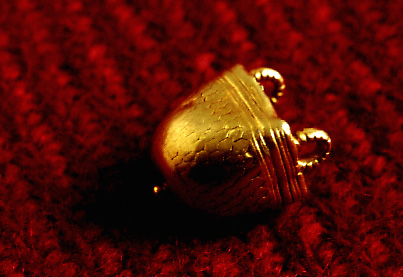
Gold pendant found in 1940. (Photo Ole Jacob Worraa
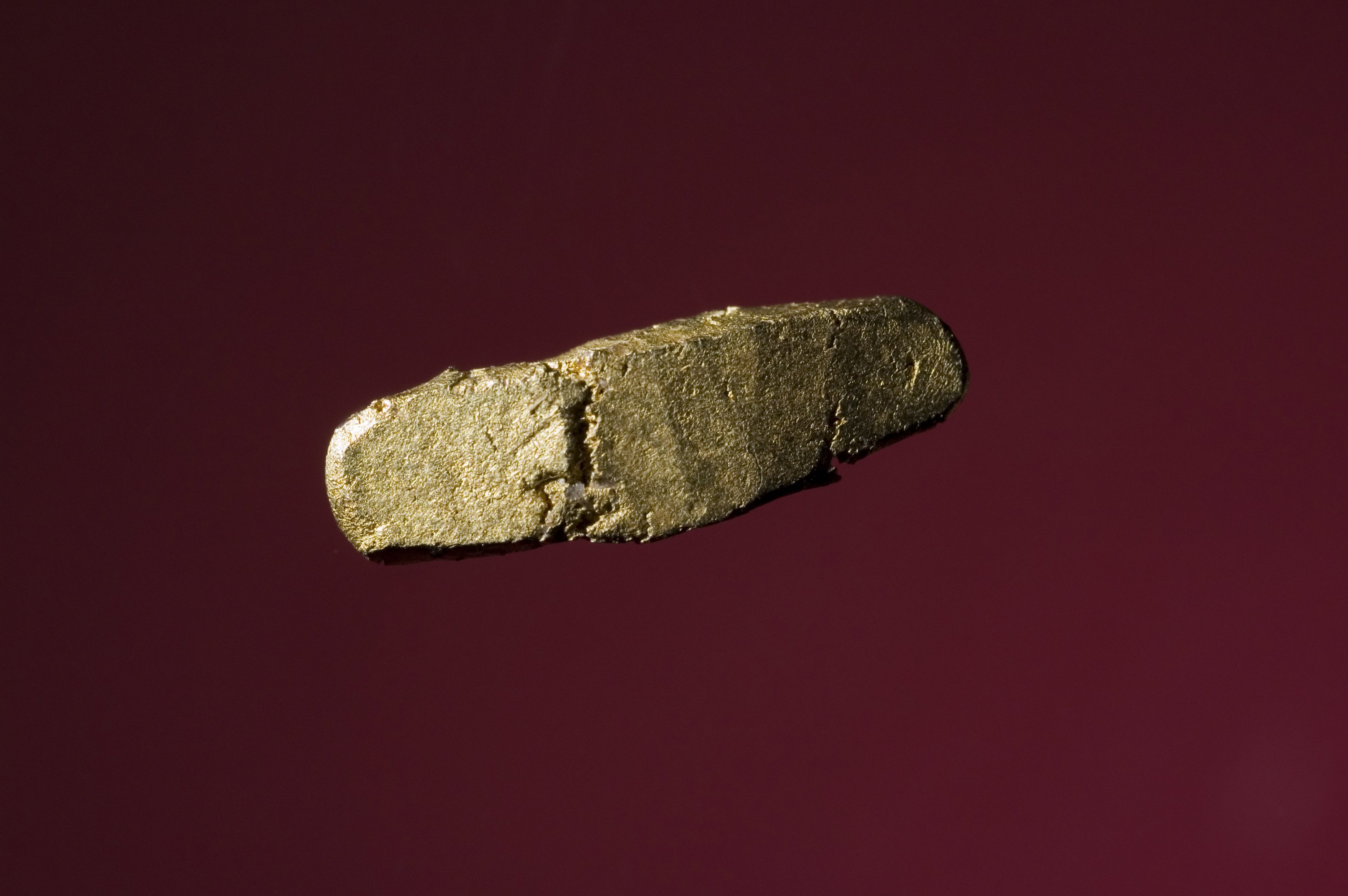
20 carat gold ingot
Towards the end of the surveys in 2005 the whole paved area was again examined with a metal detector. The device indicated a detection of gold towards the perimeter. The removal of a stone revealed a small gold ingot, measuring 14 mm in length, 4 mm wide and 3 mm in thickness. The ingot was an alloy of gold, silver and copper, with a gold content of 20 carats.
The gold ingot must have arrived at Kongshaugen as part of the earth mass placed on top of the paved area as this was not covered by earth until 1840. We have knowledge of gold ingots from discoveries of depots and it is possible that the gold ingot found at Kongshaugen could originally have belonged to an underground depot from another part of Avaldsnes. Or perhaps the ingot was originally the raw material for one of the goldsmiths who had a workshop at Avaldsnes in the Kuhaugen area?
The closest parallel to the gold ingot found at Kongshaugen is the one found at Fyn in Denmark. This one was from 500 AD. Another gold ingot, weighing 18 carats, was found at Ferkingstad on Karmøy and was dated at around the Roman/Migration Period (200 – 550 AD).
At Kongshaugen there were also postholes after several buildings. (Photo Marit S. Vea)
In 1940 a beautiful pendant of gold was found on the western slope of Kongshaugen. The pendant has been dated to the late Roman period. It might be a deposit, but has also been considered as emanating from a destroyed female burial. This pendant shared an identical gold content as the gold ingot also found at Kongshaugen.
Traces of settlement
From the midst of Kongshaugen and southwards there were found postholes. These are believed to be remnants of buildings and lie in a north – south orientation. The postholes suggest that there have been several houses here over a longer period og time. The postholes were not dated, but since it appear that the buildings continue under the circular paving, we believe them to be older than the actual burial site
See report from the excavation:
Avaldsnesprosjektet. Registreringer av Kongshaug og Gloppe 2005, Ams. Henriette Hafsaas
WRITTEN SOURCES TELLING ABOUT KONGSHAUGEN
Extracts from old articles:
Koren Christie 1842: Antiqvarisk-historisk Skitse af Augvaldsnæs. (Urda II, s. 322-347):
”Stedet, hvor Augvald blev høisat, har man antaget at være den mellem 3 og 4 hundrede Skridt vestenfor Augvaldsnæs Præstegaardsbygninger beliggende lange, lave Bjergryg, som endnu ofte benævnes Kongshougen, paa hvis Midte findes en Stump af en liden, halvomfalden Bautasten, som kanske aldrig var Bauta, og hvor før lenger syd saaes en Steenring, en Tingkreds, men som Oldtidsmindernes skaanselløseste Fiende Ploven har forstyrret”, s. 326.
”Efter Snorre stode da Bautastene, altsaa mindst to, ved Augvalds Grav. Men Spor af mere end en søger man forgjæves paa Kongshougen, og selv dette er usikkert, ligesom helleringen Beskrivelse af denne Houg leder til en saadan Antagelse, idet mindste ikke mig bekjendt. Dersom der da nogetandetsteds nærved findes eller har været at finde de af Snorre omtalte
”Bautastene,” saa har man, ialfald naar ogsaa andre bestyrkende Omstændigheder komme til, Grund til heller at søge Augvaldshøien der, end paa Kongshougen”, s. 327.
”Denne Kongshoug kan nu ifølge det her udledede Resultat ikke bære sit Navn efter Kong Augvald, og det er ved en ren Forveksling af denne og Flaghougen, at Kirkedepartementet i sin vidtudbredte ”Veiledning til at lære at læse Haandskrivt” af Hr. Provst Bruns Fund i Denne slutter til Augvalds Begravelse i hin.
Hvad der paa Kongshaugen er fundet, indskrænker sig næsten alene til et simpelt Jernsværd, som udgroves af Tingkredsens Midte deroppe. Skal her endelig være en Kongegrav, saa er maaske en af Augvalds Ætlinge her jordet”, s. 332.
”Hjør, Hjørleif, eller en af deres Efterkommere kan da være begravet paa Kongshougen, hvis vi endelig skulle søge dens Navn af en Drots Høisættelse her. Men Saadant er vel unødigt; det hidrører rimeligst derfra, at Kongerne, som den for kort Tid siden endnu synlige Tingkreds viser, her holdt Ting, og navnlig vel fra Olaf Trygvesens Tid, da han 997 her paa Tinge christnede Rogalænderne (Rygerne) og døbte dem, hvorfor Kongshougen endnu, som meldt, stundom kaldes Daabshougen”, s. 333.
N. Nicolaysen 1862 – 1866 . (Norske fornlevninger)
“Vestenfor kirken er en naturlig forhøyning kallet Kongshaugen; – og et stykke vestenfor prestegaarden en lav haug, hvorpaa det stod en sterkt hellende bautasten som blev borttagen 1861 – 1863; den stod så dypt nede i jorden, at den måtte slaaes i stykker for at faaes bort. Likeledes vestenfor prestegaarden oppdagedes 1863, under et tynnt jordlag, en temmelig udstrakt brolegning af firkantede, temmelig store tett sammensluttende stene med den flade side oppad, og saaledes at der, som det syntes, var et dobbelt lag av saadanne stene.”
J. Petersen 1934: Innberetning om reise til Avaldsnes 20-22/11-34. (Topografisk arkiv, AmS)
”Under et opphold i Bergen april d.å. ble jeg av sogneprest Skadberg i Avaldsnes anmodet om å legge veien hjem om Avaldsnes, da man hadde funnet noe som så ut som restene av et hus. Jeg reiste da innom Avaldsnes på tilbakeveien. Det var 12/4.
Her var der vestenfor prestegården en berghøyde dekket med et jordlag, den strakte seg syd-nord og gikk under navnet Kongshaugen. Man hadde pløyet og dyrket der i mange år, og nu holdt man på å pløye igjen. Det så da ut som her lå to rekker av steiner øst-vest, på tvers av høyden, som de kunne danne grunnmurene til langveggene i et hus. Det ble da avtalt at jeg skulle komme tilbake til høsten, når innhøstingen var over og foreta undersøkelse.
Det ble ikke før slutten av november at denne undersøkelse fant sted. Det ble da avdekket et område 20 m.l. og 6 m.b., der ble dog gravet helt til 11 m. i bredde. Her lå ganske tett med steiner i bunnen, men det var ikke mulig å få det til at det kunne ha vært grunnmur til veggene i et hus. Det er derimot mulighet for at her engang har ligget en steinrøys, kanskje en gravrøys. I 1842 skriver J.L. Christie i Urda II om Kongshaugen og sier at her skal ha ligget en steinkreds hvor der var funnet et sverd, men han nevner intet om at her skulle ha ligget et hus. Vi kan sikkert helt slutte at der ingen sannsynlighet er for at der her har ligget noe hus.”
”Det var ikke murene fra kongsgaarden”. (Dagbladet, 22/11 1934)
”Tirsdag begynte museumsdirektør Jan Petersen arbeidet med aa avdekke en del av Kongshaugen paa Avaldsnes for aa bringe paa det rene om den fremsatte formodning at stensetningene der kunne være rester av murene til Avaldsnes Kongsgaard. Arbeidet blev avsluttet igaar.
Museumsdirektøren oplyser en av vaare medarbeidere at der ved undersøkelse som er foretatt er avdekket omkring 100 kv.meter av Kongshaugen, og der viser sig sten like op i dagen over hele dette areal. Der er dog ingen antydning til murer. Det hele ser noksaa rotet ut og dette kommer vel av at plogen har gaatt over jordet, at der er blitt arbeidet med jorden, og at man har kjørt bort sten derfra gjennem tidene. Det er idetheletatt vanskelig aa si hvad dette kan være, uttaler direktøren, men det er mulig at det er rester av en bronsealderstenrøis.”
Last update November 22
Back